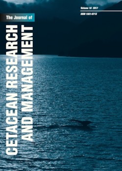
Marine traffic and potential impacts towards cetaceans within the Madeira EEZ
Contenido principal del artículo
Resumen
Human population growth has resulted in an increase of marine traffic. This has been associated with wildlife disturbance and the effects are expected to increase with continued traffic expansion. A particularly impacted group is cetaceans, known to play an important role in the sustainability and regulation of marine ecosystems. An assessment of marine traffic can therefore contribute towards wildlife conservation measures, especially when evaluated in the context of important areas for cetaceans. The present study took place in Madeira’s Exclusive Economic Zone (EEZ), an area hosting a high diversity of cetacean species as well as island-associated groups. Automatic Identification System (AIS) data were collected from a land station between 2008 and 2011 and marine traffic and cetacean visual data collected during shipboard surveys between 2001 and 2011. Results show that Madeira’s offshore traffic (up to 12 n.miles from the shore) corresponds to approximately 12% and 22% of the traffic observed in the Baltic and North Sea, respectively. It is mostly composed of cargo ships navigating over fixed routes and using the area as a passage towards different destinations. Cruise ships intersect the area mainly to reach Funchal’s port. The number of recreational boats in the area was found to be underestimated since many of them are not equipped with AIS devices. The level of Madeira inshore traffic is harder to evaluate since it is a small area encompassing a shipping route, yet it may represent 0.8% of the traffic recorded in the Strait of Gibraltar. According to the inshore shipboard survey data, coastal marine traffic is mainly composed of fishing boats (47%), recreational boats (24%), ships (17%), whalewatching boats (10%) and big game fishing boats (2%). Most inshore and offshore vessels were found to be navigating at over 10 knots. An inshore ‘higher use corridor’ common to both vessels and cetaceans was identified as a potential danger zone.
Detalles del artículo

Esta obra está bajo una licencia internacional Creative Commons Atribución-NoComercial 4.0.
You are free to:
- Share copy and redistribute the material in any medium or format
- Adapt remix, transform, and build upon the material
- The licensor cannot revoke these freedoms as long as you follow the license terms.
Under the following terms:
- Attribution You must give appropriate credit, provide a link to the license, and indicate if changes were made. You may do so in any reasonable manner, but not in any way that suggests the licensor endorses you or your use.
- NonCommercial You may not use the material for commercial purposes.
- No additional restrictions You may not apply legal terms or technological measures that legally restrict others from doing anything the license permits.

